
Coming back to the past: Ruins of Brederode Castle and the Atlantic Wall
Cycle past IJmuiden's wartime bunkers and the ruins of Brederode Castle, with a route description and practical guidance for following it.

🚴 Route By Bike
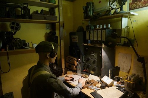
During the route, you’ll discover part of the Netherlands history. Principally it’s about Second World War. You’ll get into the Atlantic Wall of IJmuiden which is formed by many bunkers built by the Nazis to protect themselves against a potential attack along the Atlantic coastal. Besides, you can visit the Bunker Museum, where you can enter some bunkers and see personal belongings, guns and other things of the period. It’s weird to go all over the museum and the Atlantic Wall like you are walking in a park: you remember all what happened, and you get a feeling of sadness and even horror. Anyway, if we don’t want that to happen again, we should know the history, and the best way is first-hand.
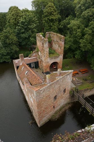
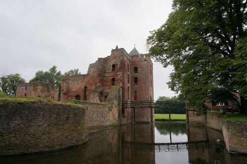
On the way, there is an another historical place which is a must-visit: the Ruins of Brederode Castle. It’s very genuine, and you can climb the tower and see the views from the top.
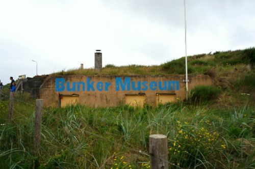
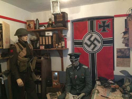
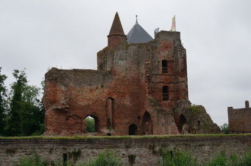
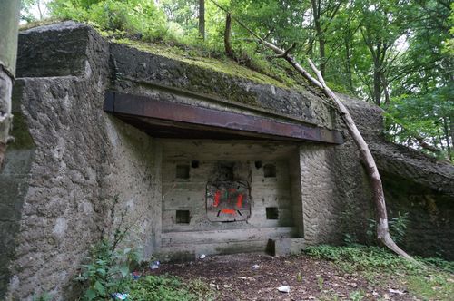
On this post, I’m going to explain all you need to know to do the route: links with important information, the GPX route to download, photos, a map and the description of the route.
📕 Essential Information:
Bunker Museum IJmuiden (Stichting WN2000), bunkermuseum.nl: run by volunteers, open April to October on the 1st and 3rd Sundays, plus November’s 1st Sunday, 11:00 to 17:00. Ticket office closes at 16:00. Adults: 8 euros; children 5 to 12: 5 euros. Dutch guided tours: 1 hour at Kustbatterij Heerenduin or 2 hours including Flakbatterij Olmen. Outdoor tour: 10 euros. Booking by email is recommended.
Ruine van Brederode, ruinevanbrederode.nl: March and April, weekends only; May to October, Wednesday, Thursday, Saturday and Sunday, 11:00 to 17:00. Entry: 7 euros from age 16, 5 euros for children 5 to 15, free up to 4. You can climb the tower.
The Bunkerroute is now at ijmuiden.nl: 2.5 km with QR code signs along the way. There is a PDF to download if you don’t have a smartphone. The Bunker Museum is stop 15.
📕 More Information: There are many websites with useful information about the Atlantic Wall, and other places to visit. I’ll tell you some pages I checked so you can investigate more if you want.
Atlantik Wall Platform // Atlantik Wall Platform, IJmuiden – Information about the Atlantic Wall.
Wikimapia.org (Categories ➜ military, area of Velsen) – Map where you can find several military sites if you select the military category. All the red points are bunkers or similar structures. This map is made by the users.
BunkerSite, Netherlands // BunkerSite, Festung IJmuiden – Photos and information of the bunkers.
Forteiland IJmuiden can be visited on the first Sunday from March to November, plus a few Wednesdays in July and August. It costs 15.50 euros per person, including the boat and a guided tour, about two hours altogether. You can buy tickets online at forteilandijmuiden.com, in Dutch and English.
➽ Description of the route
The route is 20 km. We started the route at Santpoort Zuid Station. Our first stop was The Brederode Castle.
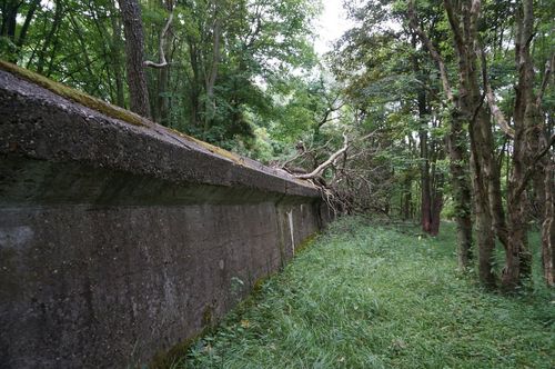
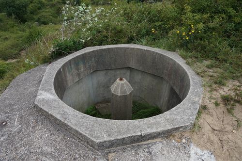
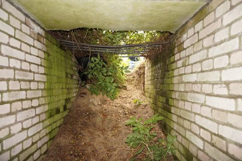
Then we went to the Nationaal Park Zuid-Kennemerland. We left our bikes on the way and went on foot to see a bunker, a tobruk, walzkörpersperre and part of the anti tank ditch; all of them are abandoned. But, what are these constructions? The next links explain more: Bunker Wn92 1 R676, Walzkörpersperre and tobruk (the photos of this tobruk don’t show what I saw, they may be examples).
It’s possible to get into the tobruk (you need to crouch, and a flashlight inside) and go out for another ‘hidden door’:
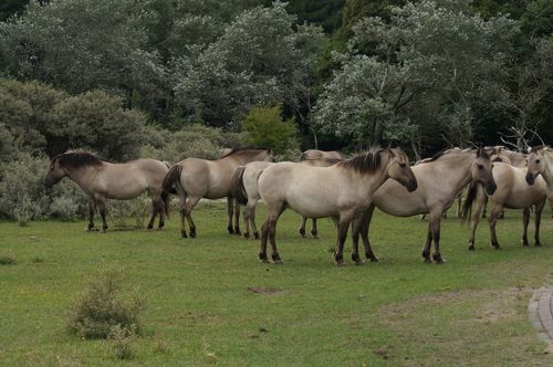
When we were going through the national park a group of horses surprised us! This park is amazing, we’ve been there before and we loved it, you can read more about the park on the dedicated post: Awesome full of life forest – National Park Zuid-Kennemerland.
We continued the way to the Bunker Museum. About 1 km before the museum there is another important place: Torpedo Storage Bunker 77. Nowadays, it is used as a building for rock musicians to practice. Finally, we arrived at the museum. After visiting it, we did the 45 minutes tour with a great guide who explained us in English 😅 (and obviously in Dutch) several interesting curiosities about the Atlantic Wall.
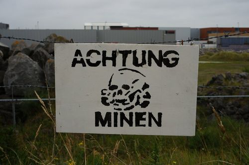
After the tour, we took the bikes again and carried on with the Bunkerroute, described on IJmuiden’s tourism website. The path is not a bike path, there are little stones and sand. It is possible by bike, but we walked most of it to see the bunkers. The route now has signs with QR codes at each bunker explaining the history. These are an update since our trip in 2017. There is still a PDF to download if you prefer paper.
Many of the bunkers are filled with sand but we were able to enter to 3 or 4 of them and explore inside:
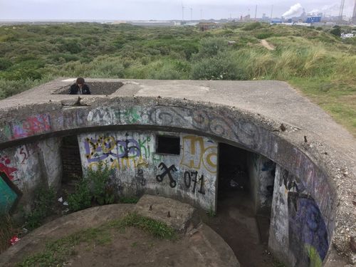
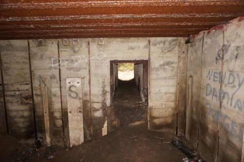
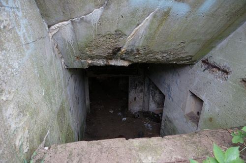
At the end of the Bunkerroute, we arrived at the bike path again. We tried to see other points: Anti Tank Wall Wn85, Anti Tank Barrier Wn85, Emplacement Wn85, Bunker Wn85 and Tobruk Wn85. I marked these points on the route but we couldn’t see them because we didn’t find the way to reach them. Maybe you could be luckier. This was the last thing we did before returning to the Driehuis Station to go back home.
Extras: There are more places around IJmuiden like the Forteiland (I’ve already mentioned it on More Information) and other tobruks and bunkers in the area that you can search on Wikimapia.
➽ How to do the route?
On the next map, you can observe the complete route and all the waypoints we saw (and also what we didn’t see). Take a look at the map to know where each place is. Besides, there is more information if you click on the icons.
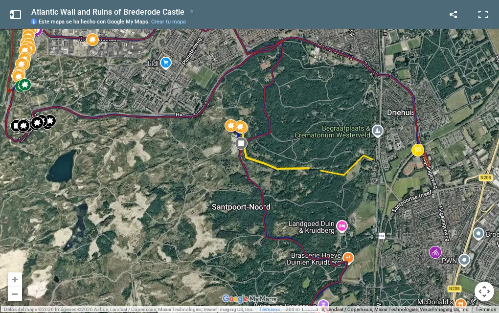
The blue way is the final route we did and the red one was the one I planned along an official bike path. Both are equal except for 1’5 km. That different piece is the Bunker Route (formed by many points). It is located near the Bunker Museum (the brown area).
The black icons are the waypoints we couldn’t see. Besides, we skipped two places (green color), for that reason I suggest you to follow the pdf.
Click on the next link to download the route we did, this includes all the mentioned points. Keep in mind that on the map you see different colors and icons but on your phone app these characteristics are unavailable. In your phone, points only have one color and one icon.
Route GPX: Ruins of Brederode Castle and the Atlantic Wall.
How do you use the GPX on your mobile phone?
First, you need an offline map app which allows the GPX format. I use OsmAnd. The app hasn’t maps so you should download the map of The Netherlands following its options. Next, you open the file with the app (you can send it by email and when you open it, the app will appear). You should check that you can see the route with your device. Now, you’re ready to use the phone as GPS (and with no Internet)!
Now, the last important thing: the bike. We brought our own bikes. If you need to rent, there are these options.
OV-fiets at Santpoort Zuid station has a self-service rack with 14 bikes, open 24 hours. It costs 4.80 euros per 24 hours in 2026. You need a personal OV-chipkaart with a free NS OV-fiets subscription. Tourists without one cannot rent.
Rijwielhuys, Narcissenstraat 12 in Santpoort-Noord, still exists, with new owners since 2023. Its website, rijwielhuys.nl, no longer mentions rental, so I recommend checking with the shop before counting on it. If you rent there, get off at Santpoort Noord instead of Santpoort Zuid.
Uw Deelfiets offers shared bikes through a smartphone app at Driehuis station, where the route ends, and other spots in IJmuiden. More information: velsen.nl/fietsverhuur.
If you know another place, please tell me and I’ll add it to this post, thanks!
➽ More activities in the Netherlands on Extra Netherlands.
Any contribution or question is welcome, please write a comment!
Comments (0)
No comments yet.
Leave a comment