
So many deers! - Amsterdamse Waterleidingduinen
Explore the Amsterdamse Waterleidingduinen on foot, with entry details, transport options and GPX routes among dunes, deer and wartime bunkers.

Hiking
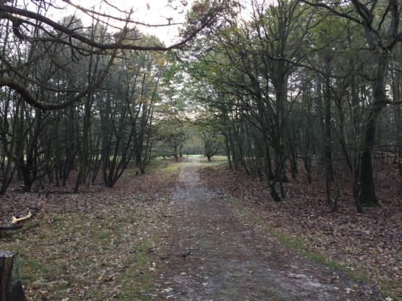
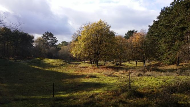
Where is it? It is located between Zandvoort and Noordwijk. Maybe you don’t know or recognise the name of the place, it is written in dutch 😊. I give you two clues: many dunes and Waternet (it is a water company). If you live in Amsterdam you should know the place! Waternet is an important water company, actually the only water company in Amsterdam. The water we drink comes from that place. It is a big park of 3.400 hectares with incredible dunes, a woods area, many deers, birds, foxes and obviously water canals. Besides, you can also come across the old bunkers from World War II.
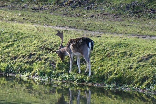
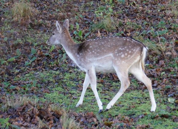
The park is special because the deers are very used to see people near them. They stay eating or simply watching you if you are 10-20 metres from them, if you get closer then they run away. You can take a beautiful picture of deers easily 😊.
An important thing: the bikes and domestic animals are prohibited, you can only walk on the trails or ride a horse with a permission. If you’re thinking of going with children there are activities for them (check the website below). In any case this place won’t disappoint you.
📕 Route Information: Amsterdamse waterleidingduinen
I know the information is in dutch, don’t worry I’m going to explain all you need. Also you can translate with your web browser or Google Translate.
There are 4 gates to the area, check on the map ➜ Hiking / So many deers! – Gate n, where ‘n’ is 1,2, 3 or 4. You pay €1,50 per day or €10 annually, under 18s enter free. Since 1 May 2025, no gate ticket machines remain. I recommend buying online beforehand from the AWD shop. Or scan the gate QR code, pay with your banking app and receive a PDF ticket by email. Paper tickets: only at visitor centre De Oranjekom (Tuesday to Sunday, 10:00 to 16:30). Parking: €1,50 per hour, maximum €6 per day, paid by card with licence plate recognition.
Which entrance should you choose? It depends on where you come. Google maps can provide you with timetables or you can check also the local public transport site to choose the best option for you. I chose the gate 3 so I took a train from Amsterdam Central to Heemstede-Aerdenhout and bus 80 from there to gate 3, in total 40 minutes. Keep the bus frequency in mind because the most frequent bus is the number 80, two times an hour.
➤ How to do the route?
There are several routes in the park. On the official site you can find 24 walking routes, from 3 to 30 km. Each has the distance, time and starting gate, plus a free GPX file you can download and follow on your phone. I know the site is in Dutch, but you can take the route with you on your phone! I normally use Wikiloc to search routes. This webpage has many trails to choose (you should register on the website Wikiloc if you want download one of these). I’ve selected some of them starting in gate 3:
- Circular Route: 10,3 km, about 3 hours (Wikiloc) (you can start this route in the gate 2 as well).
- Circular Route (short): 7 km, about 2 hours 30 minutes (Wikiloc).
My customized gpx file: click here to download the file (you just need to uncompress the zip file). The gpx file contains several alternative paths so you can choose, just take a look at the map below and you’ll understand it.
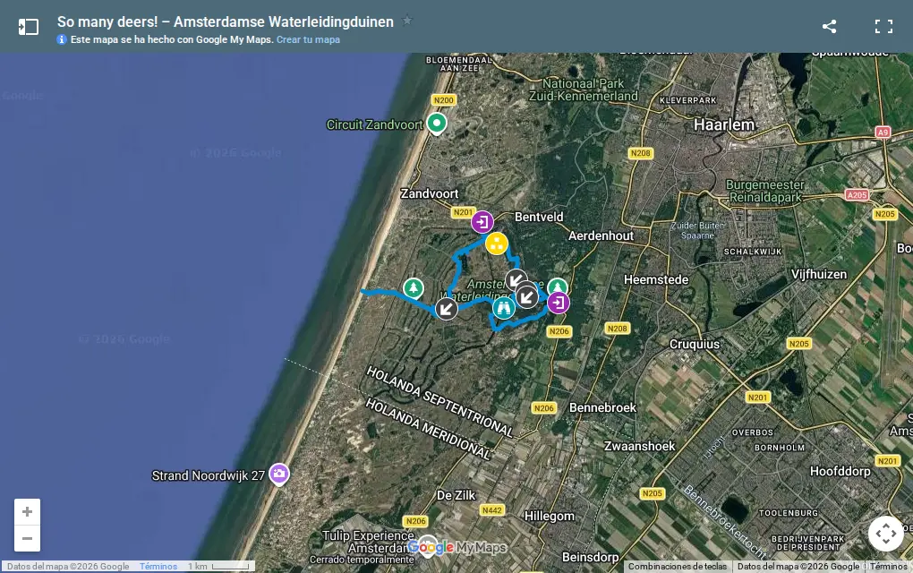
The longest route is around 17 km (it depends on the chosen path). If is too much then you can shorten 4 km the route if you remove the path to the beach. And finally here you can access to the route I did (9 km passing through a birds’ viewpoint and bunkers).
So, the steps are:
First, you download the trail you like.
Then, you need a mobile application or a Garmin device to use the file. If you have a device you know what to do, otherwise continue reading.
The mobile application that I’ve mentioned is an offline maps like OsmAnd or Wikiloc App. It is used to open and follow the trail, so you don’t get lost. In addition you will keep your phone’s battery level. You choose and install one app in your phone and open the gpx file.
Now, you are ready to go!
➤ My experience
I know others parks close to Amsterdam that are free but this is very special because of the number of deers in their natural habitat that you can find. In fact, only 300 metres walking from the gate I saw some deers in front of me! Besides, there were no bikes! so the place and the walk was quiet 😄. During the route we found a birds’ viewpoint. If you are interested in birds don’t forget your binoculars! The viewpoint is indicated in my gpx file.
I walked more or less 9 km in a circular route (about 4 hours with stops). I couldn’t reach the beach because of the bad weather. As I already told you if you add the path to the beach it is 4 km more.
I visited the park in autumn, the colours of the trees were beautiful but that day the weather was crazy: sun, sometimes cool, some hail and sun again. This is the typical day in the Netherlands 😊 but, despite the weather, hiking was great!
I think I’ve given you good reasons for hiking in this place, don’t wait anymore, just go! 😄
➽ More activities in the Netherlands on Extra Netherlands.
Any contribution or question is welcome, please write a comment!
Comments (0)
No comments yet.
Leave a comment